
Vincent Brown
Principal Investigator and CuratorCharles Warren Professor of History and Professor of African and African-American Studies
Director, History Design Studio
Harvard University
brown8@fas.harvard.edu
This animated thematic map narrates the spatial history of the greatest slave insurrection in the eighteenth century British Empire. To teachers and researchers, the presentation offers a carefully curated archive of key documentary evidence. To all viewers, the map suggests an argument about the strategies of the rebels and the tactics of counterinsurgency, about the importance of the landscape to the course of the uprising, and about the difficulty of representing such events cartographically with available sources. Although this cartographic narration cannot be taken as an exhaustive database—for instance, it does not examine major themes such as belonging and affiliation among the insurgents or the larger imperial context and interconnected Atlantic world— the map offers an illuminating interpretation of the military campaign’s spatial dynamics.

Project DescriptionProject Description
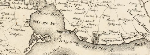
In 1760, some fifteen hundred enslaved black men and women— perhaps fewer but probably many more— took advantage of Britain’s Seven Year’s War against France and Spain, to stage a massive uprising in Jamaica, which began on April 7 in the windward parish of St. Mary’s and continued in the leeward parishes until October of the next year...
Multi-layered Interactive MapMulti-layered Interactive Map
Mapping the great Jamaican insurrection of 1760-61 allows us to see how the island’s topography shaped the course of the revolt, how the rebellion included at least three major uprisings, and how its suppression required the sequenced collaboration of several distinct elements of British military power...